Rwanda is often affected by severe cases of landslides and floods. It is also one of the highest populated areas in the world. This context of strong demographic pressure has led to significant land use/land cover (LULC) change, which is likely the cause of an increase in landslide and flood occurrences, particularly in the mountainous regions of North West (NW) Rwanda near the Volcanoes National Park (PNV).
Nonetheless, the impacts of LULC change on the occurrence of these hydro-meteorological hazards remain difficult to predict and quantify. As a result, the development of suitable land and water management strategies remains highly challenging. In 2019, INES-Ruhengeri has partnered with the University of Liege, the University of Namur, and the Royal Museum for Central Africa Tervuren, to formulate the project entitled “Landslide and flood hazards and vulnerability in NW Rwanda: towards applicable land management and disaster risk reduction”. The project has been selected to be financed by the Belgian Cooperation through the “Académie de Recherche et d’Enseignement Supérieur (ARES)”.
It aims at studying the effects of Land Use/Land Cover (LULC) change over the past 60 years on the magnitude and frequency of landslides and floods, as well as the impacts of these hazards on the population. It consists of funding three sandwich PhDs and six local masters that would focus on understanding flood hazards, the landslides and their relation to LULC, and the assessment of vulnerability and risks due to both flood and landslide hazards respectively. Due to the COVID-19 pandemic and lockdown resulting in the suspension of almost all flights wherever the world, the first Ph.D. candidate who is doing his research on understanding flood hazards has started his research in Rwanda at the beginning of April 2020.
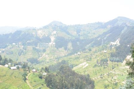
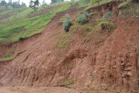
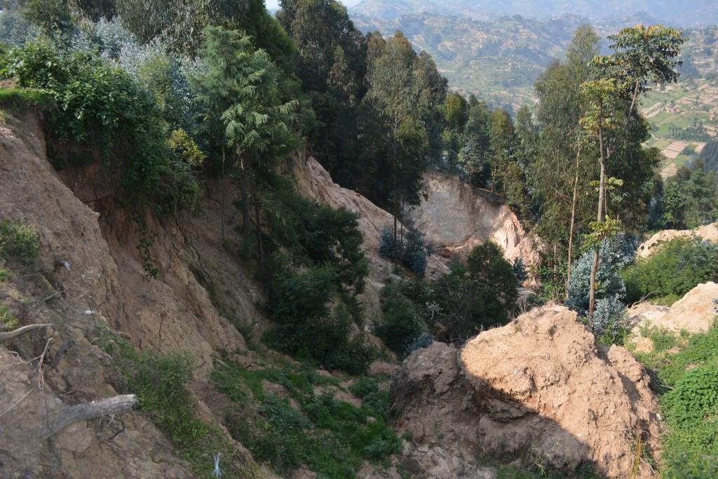
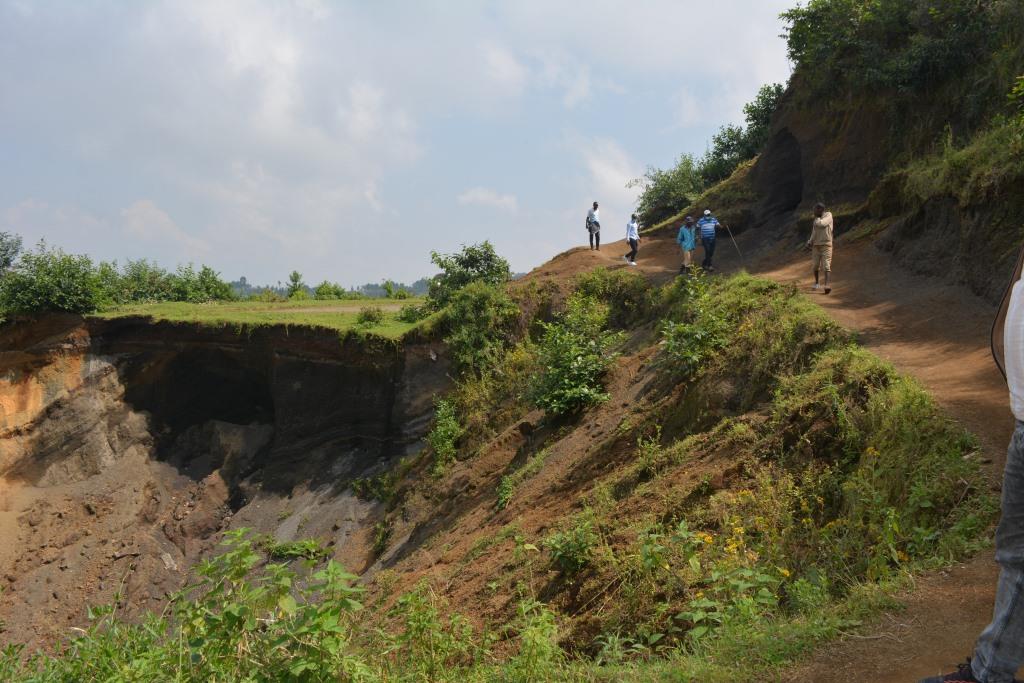
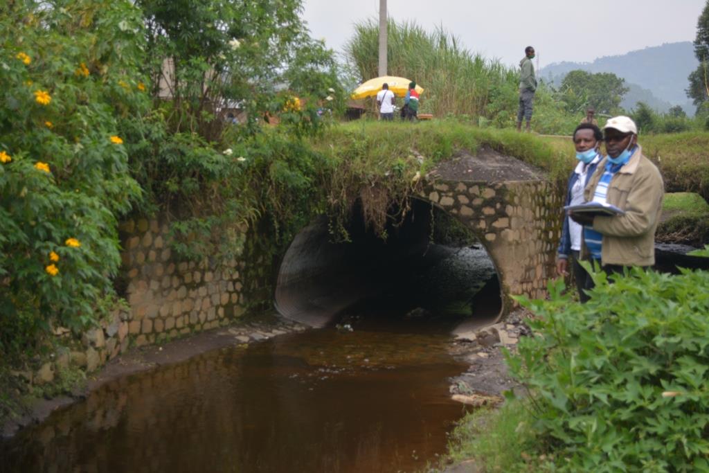
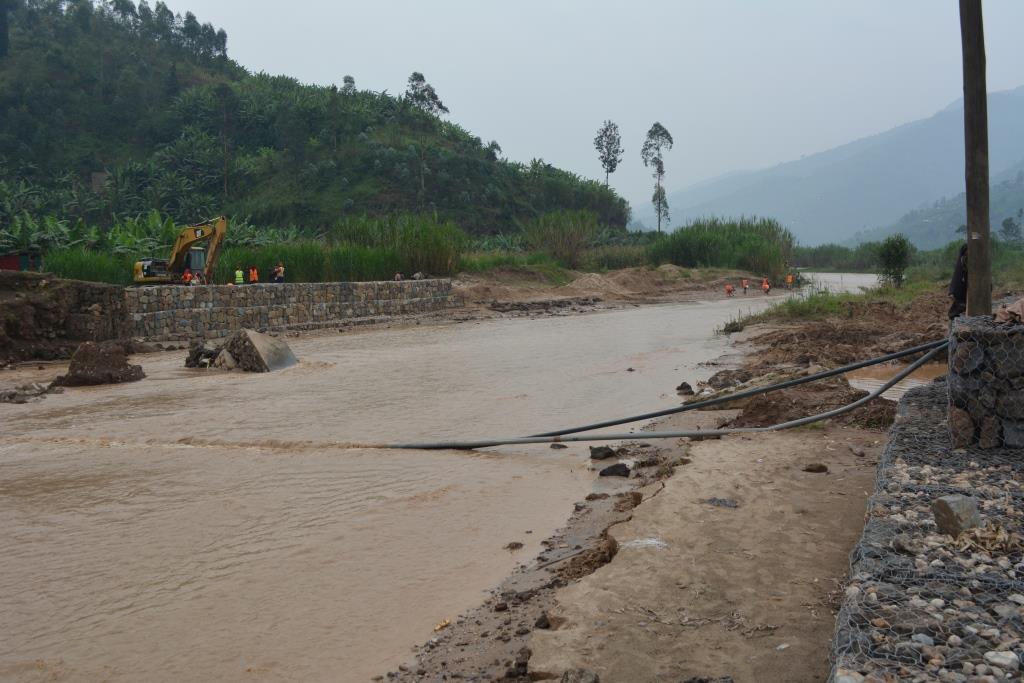
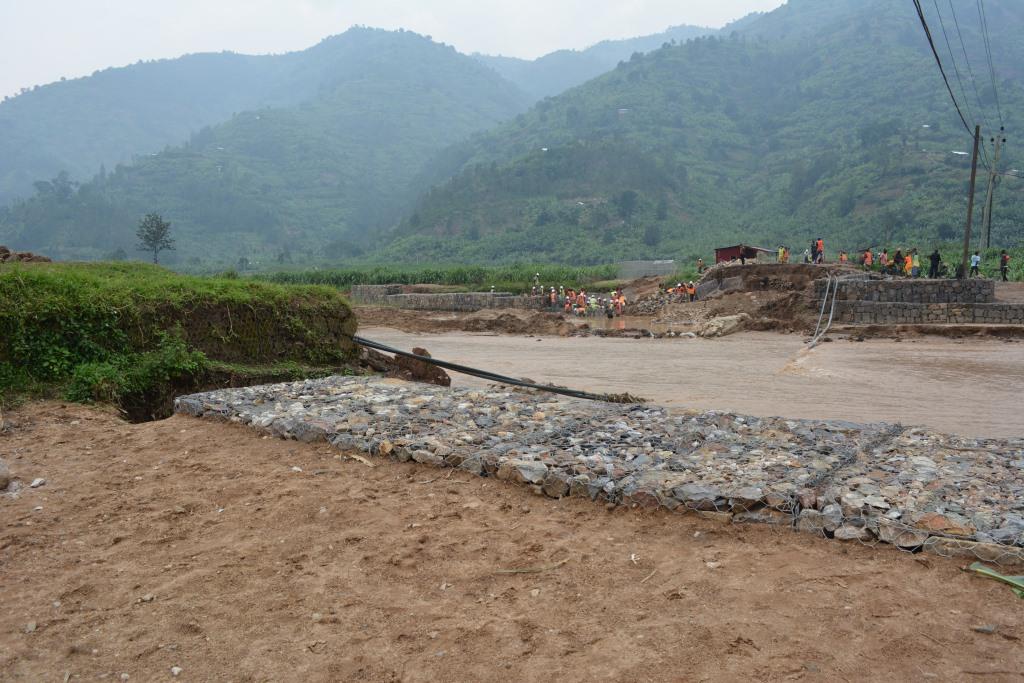
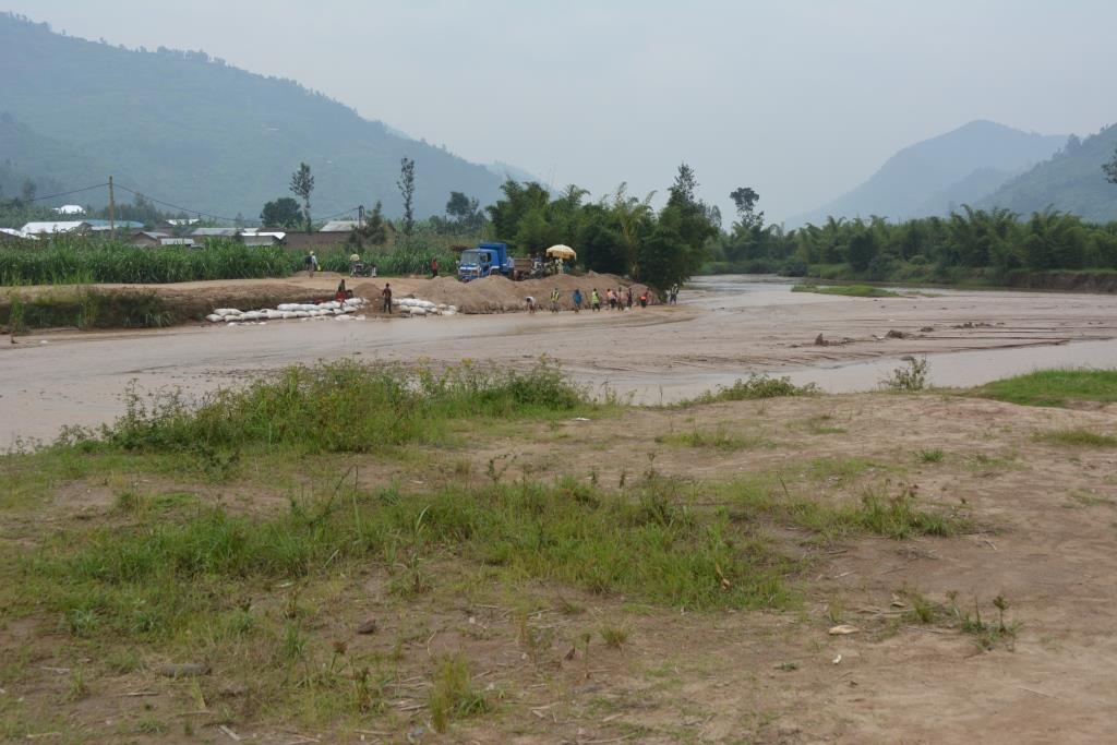
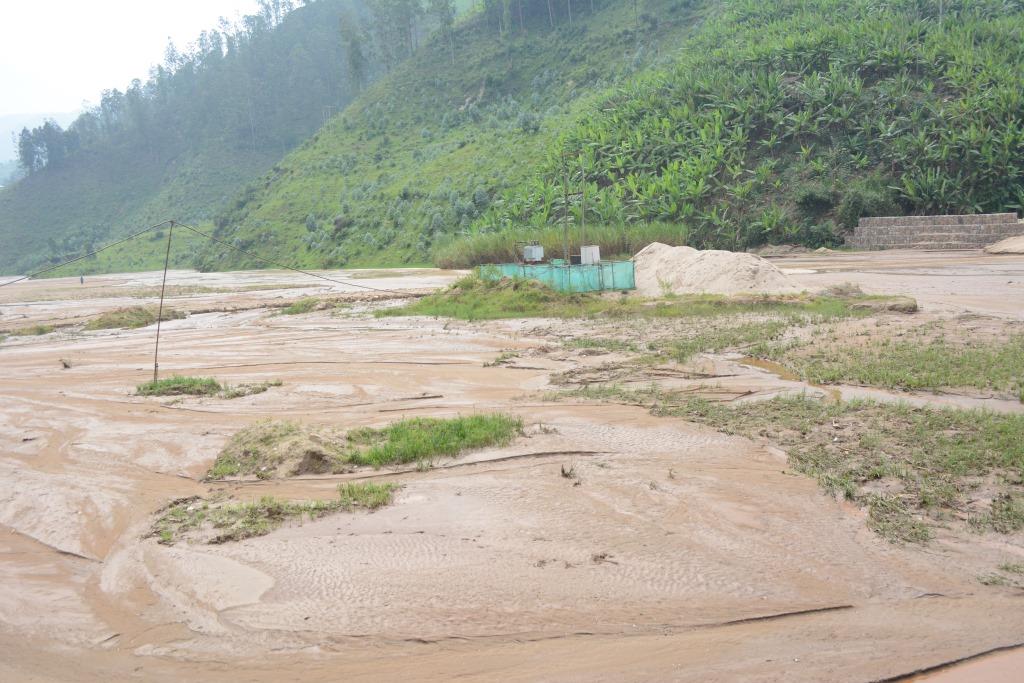
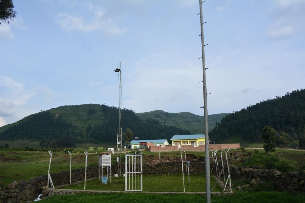
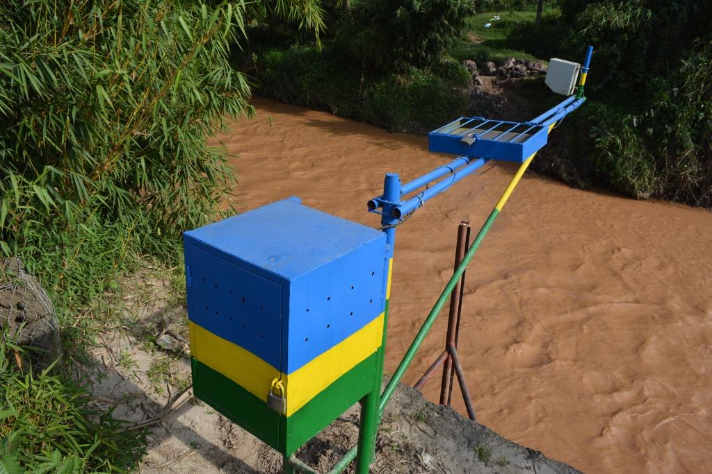
Later on, in August 2020 other two PhDs candidates were selected based on their expertise in landslides and hazards vulnerability respectively. After elaboration of the new strategies of working under imposed sanitation measures from the COVID-19, all Ph.D. students were invited to meet their north supervisors and doing intensive training in Belgium. That period was also concerning to better refine the research objectives, questions, hypotheses, and methodologies. Two Ph.D. students (for Landslide and Flood Hazards) were together requested to identify where they are proposing to install equipment that will be used in data collection. The following pictures briefly describe and show where some flood and landslide events have recently happened in the study area. They are also showing some critical areas where data collection can be conducted in the study area.